subota, travnja 18, 2015

Solid waste in Ecuador

Waste generation and its management are sensitive subjects for most municipalities, and even more so in the developing countries, where problems encompass the growing production of waste, very low consumer consciousness, limited incentives for separation of waste at the source, problems in the recycling chain, disposal management, to name a few.

When it comes to impacts of waste generation and management, they range from air contamination and release of greenhouse gases that contribute to global warming, leachates that contaminate water and soil with chemicals such as heavy metals and organic compounds, and numerous health effects for the waste management workers and local populations.

In Ecuador, the current solid waste generation rate is 0,81 kg/person/day, but there are large differences between regions. According to Soliz Torres (2015), the differences between the highest and lowest producing cantons are extreme and range from 0,1 to 2,21 kg/person/day for 2012.

The great majority of waste disposal sites in the country are waste dumps that use virtually zero management techniques, but they are in a process of being closed permanently and substituted by sanitary landfills that generate fewer health and environmental impacts, a goal that should be accomplished by 2017.

Unfortunately, due to the confidentiality agreement of my work contract, I can’t publish my own work regarding the subject, so instead I present here a map published by Soliz Torres in a very interesting article entitled “Political ecology and critical geography of waste in Ecuador”.


Source: Soilz Torres (2015):  Political ecology and critical geography of waste in Ecuador.  Letras Verdes. Revista Latinoamericana de Estudios Socioambientales N.° 17, marzo 2015, pp. 4-28


srijeda, veljače 25, 2015

Conservation prioritization

The time has come to do some more research on my thesis, which deals with identifying conservation priorities in the Galapagos Islands.

http://www.galapagostours.net/images/galapagos-map.jpg


The field of identifying conservation priorities is known as conservation prioritization, and can be defined as “the process of using spatial analysis of quantitative data to identify locations for conservation investment”[1], which isn’t applied only to protected areas, but can also pertain to management strategies and conservation activities outside them. One of the more important considerations in conservation prioritization is that of comprehensiveness, by which the ideal conservation area should contain the composition, structure and function representative of the biodiversity feature. The complementarity principle should also be considered, since it states that costs should be optimized while ensuring that all biodiversity features receive benefit; furthermore, prioritization should be designed for the long term, with considerations for cost-effectiveness and taking into account threats that biodiversity faces.

The prioritization is a socio-political process, in which the goals are determined by societal considerations, but one in which science is the key provider of technical information and options. Even though mapping of the relevant factors is in itself an important aspect of this process, it should not focus solely on this tool in order to design a successful conservation strategy, but also include stakeholders opinions, development of scenarios, of decision support systems, social marketing, facilitation and conflict resolution, institutional establishment, monitoring and management, to name a few. The scope of the current work, however, only includes the production of the prioritization map due to technical, political and economic restraints.

http://i.telegraph.co.uk/multimedia/archive/01692/galapagos_1692336c.jpg


The identification of conservation goals is the initial phase of the process, followed by identifying the variables (factors or system attributes) to be considered, which is a scientific and technical stage involving the understanding and describing of the dynamic relations that define the ecology of a system. The next phase requires the gathering of information of the previously defined factors, which should principally be spatial information; in the absence of georeferenced data, carefully selected proxies can be used. The final and critical phase is to perform the prioritization analysis itself by means of one of the two basic principles: scoring of factors or complementarity based approach.

A variety of software has been designed with the purpose of aiding in the process of conservation prioritization analysis, such as MARXAN, Zonation, C-Plan, Res-Net, and this current work will use one such tool (Environmental Risk Surface, ERS) in order to determine priority conservation areas in the 
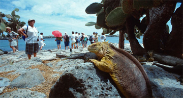
Galapagos Islands. Literature pertaining to the ERS software is extremely limited, therefore the main basis for this investigation is the work of McPherson et al. (2008) and Lessmann et al. (2014), both assessing human impact on conservation. McPherson et al. use GIS tools to assign weight and distance of influence to several human activities and map its impacts, in order to identify optimal conservation areas in Jamaica. Lessmann et al., on the other hand, use GIS map the distribution of target species, include conservation feasibility costs, in order to identify conservation gaps in Ecuador. Both articles focus on conservation efforts while evaluating and mapping the effect of such human influences as population, roads, tourism, agriculture, mining, and will thus offer guidance in the judgment of their impact.

References
Ferrier, S., & Wintle, B. A. (2009). Quantitative approaches to spatial conservation prioritization : matching the solution to the need. In Spatial Conservation Prioritization. Quantitative Methods and Computational Tools (p. 328). New York: Oxford University Press. 
Knight, A. T., Cowling, R. M., Possingham, H., & Wilson, K. A. (2009). From theory to practice: designing and situating spatial prioritization approaches to better implement conservation action. In Spatial Conservation Prioritization. Quantitative Methods and Computational Tools (p. 328). New York: Oxford University Press.
Lessmann, J., Muñoz, J., & Bonaccorso, E. (2014). Maximizing species conservation in continental Ecuador: a case of systematic conservation planning for biodiverse regions. Ecology and Evolution, n/a–n/a. doi:10.1002/ece3.1102
McPherson, M., Schill, S., Raber, G., John, K., Zenny, N., Thurlow, K., & Sutton, H. (2008). GIS-based Modeling of Environmental Risk Surfaces (ERS) for conservation planning in Jamaica. Journal of Conservation Planning, 4, 60–89.

[1] Wilson, Cabeza, & Klein, C., 2009, pg. 16

nedjelja, prosinca 28, 2014

Does Santa use GPS?

'Tis the season to be jolly... and wonder how Santa Claus gets around the world in just one night, getting every child's address right, especially considering that the world population gets bigger and bigger every year. The world today counts around 7,2 billion and around 31% are Christians, so that's a pretty large number of kids to visit in just one night!

Does he use a GPS to get around? Maybe... It would definitely make sense, considering the daunting responsibility that rests on his shoulders, so that option makes sense to me, technically speaking. But thinking that he's been around for so long, and that there's definitely magic involved with everything Santa does, at heart I believe he prefers the old-fashioned stellar navigation.

source: prweb.com
Whichever the case, there's a few websites that let you keep track of Santa's progress through the Christmas night, so you can stay up and wait for him with cookies and milk and ask for yourself about how he navigates the skies; here's to list just a few:

Google's Santa tracker  - personally my favorite :) 
NORAD's website
TrackSanta

source: santatracker.google.com

Santa did his job really well this yeas, as always, so he's taking his well-deserved break till the preparations begin for next season. And the mystery still remains as to how he gets around the whole globe in just one night...

nedjelja, studenoga 16, 2014

Online Courses

I've been doing a lot of ESRI online courses lately as part of the UNIGIS program, and I have to say - they're really good. There are two basic types of courses offered by ESRI - instructor-led courses and online courses. Being in Ecuador, only the online courses are available to me, though I hope to someday be able to have a live course too.


The online courses are nothing to complain about, though. Lots of useful topics with a good theoretical introduction, often solidifying the basics and then followed by well-explained exercises - a good combination between theory and practice. So far, my favorites are the 3D visualization technique courses and site selection courses.

Sometimes, though, it can be difficult to know the best order to take them in, and then I end up doing a more advanced course first or repeating some topics, but that's not such a big problem. After all, repetitio mater studiorum est!

utorak, listopada 07, 2014

Thesis time!

The time has come to face the final challenge in the UNIGIS Master program: the thesis.

Being an ecologist, I wanted the work to take into account my interests, both personal and professional. And, I am currently working on a project regarding the world-famous Galapagos Islands in Ecuador, so I thought why not combine both. After some research, I think I found my topic: Identifying terrestrial conservation priorities in the Galapagos Islands, based primarily on anthropogenic threat assessment.

http://nothingtoloseandaworldtosee.files.wordpress.com

The conservation of the famed Galapagos Islands experienced two crucial points during its history: it started officially in 1959 with the creation of the Galapagos National park, and was later expanded to the marine ecosystem by forming the Galapagos Marine Reserve in 1996. However, by that time, the archipelago had experienced severe human influence that first started with the discovery of the Islands in 1535, intensifying strongly with the beginning of organized colonization in 1983 and continuing relentlessly ever since. Today, the Galapagos NP encompasses 96,7% of the islands (7 731 km2) and the Marine Reserve reaches up to 40 miles from the Islands (138 000 km2), but anthropogenic influence is still great and poses a significant threat to the conservation efforts.

The primary factor of influence is tourism, which has sky-rocketed in the last decades, causing strong immigration of the Ecuadorean population from the continent, bringing with it almost complete dependence of energy, food and water from the continent, and causing a host of problems: introduced and invasive species, illegal and uncontrolled fishing, contamination of aquifers and soil, inadequate or (for the most part) inexistent solid waste and residual water management, rampant urbanization, among others. These factors keep altering the fragile ecosystems of the Galapagos Islands, despite the constitutional protection that Pacha Mama (Mother Nature) enjoys in Ecuador and the continuous efforts of the NP and Marine Reserve management.

http://static.guim.co.uk/sys-images/Travel/Pix/pictures/2006/04/19/galapagos360.jpg


Despite the strong scientific interest in Galapagos, there have been few attempts to quantify the anthropogenic influences suffered by the ecosystems. However, it is precisely by means of a thorough evaluation of human risk factors risk that conservation of the Islands should be managed, in order to aim its valuable and costly efforts into particular human activities, specific areas and species.

The objective of the project will be to perform an ecological risk assessment for terrestrial conservation in the Galapagos Islands based on anthropogenic risk factors, and identify areas that represent conservation priorities.

So… the next step is to gather all the information available in order to identify, quantify and spatially delimit the influences that the terrestrial ecosystems of Galapagos face due to various human activities, and also to identify and localize the distribution of target terrestrial species on the islands. With that, it will be possible to identify areas that require particular conservation efforts, based on an overlay of quantified threats and identified species, and finally to produce a map of conservation priority areas.

So now cross my fingers and start working…
I may not have gone where I wanted to go, but I'm sure I ended up where I needed to be.